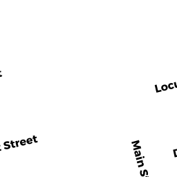
15 LOCUST ST
Owner Information
None
15 LOCUST ST
EVERETT, MA 02149


Property Details
15 LOCUST ST is classified as a Three-Family Residential (Multi 3 fam).
The primary structure on this property was built in 1900. There are 8,392ft2 of built area within this property. There is 5,528ft2 of residential/living space within this property. This property is listed as having 16 rooms. There are 3 units within this property.
15 LOCUST ST is valued at $1,532,500. The land is valued at $240,700 and the structures are valued at $1,278,700. There is an additional valuation of $13,100 on this property.
This property is in Zone DD. Confirm with local Zoning Board authorities to ensure there are no overlays or other easements on this property.
Assessment data from fiscal year 2022.
Flood Data
According to the FEMA National Flood Hazard Layer, this property does not appear to be in a flood zone. It may also be in an area not yet reviewed. Nonetheless, confirm this information prior to taking any action.
To view the flood hazards around this property, create a FEMA "Firmette" Map of the area around 15 LOCUST ST.
Broadband Internet Providers
| Provider | Type | Bandwidth (mbps) | |
|---|---|---|---|
| RCN | Cable | 1000 | 20 |
| Crown Castle Fiber | Fiber | 0 | 0 |
| Viasat Inc | Satellite | 100 | 3 |
| Verizon New England Inc. | DSL | 7 | 0 |
| Comcast | Cable | 1000 | 35 |
| RCN | Cable | 500 | 20 |
| Starry, Inc. | Fixed Wireless | 200 | 200 |
| netBlazr Inc | Fixed Wireless | 50 | 50 |
| GCI Communication Corp. | Satellite | 0 | 0 |
| HughesNet | Satellite | 25 | 3 |
| VSAT Systems, LLC. | Satellite | 2 | 1 |
Broadband service provider data from December 2020.
Adjacent Properties
- 10 DYER AVE 10
Residential Condominium owned by None - 12 DYER AVE 12
Residential Condominium owned by None - 10 12 DYER AVE
Condominium-Association owned by None - 14 16 DYER AVE
Condominium-Association owned by None - 14 DYER AVE 1
Residential Condominium owned by None - 16 DYER AVE 2
Residential Condominium owned by None - 11 LOCUST ST
Two-Family Residential owned by None - 20 DYER AVE
Single Family Residential owned by None - 21 LOCUST ST
Two-Family Residential owned by LIANOS CHRISTOPHER